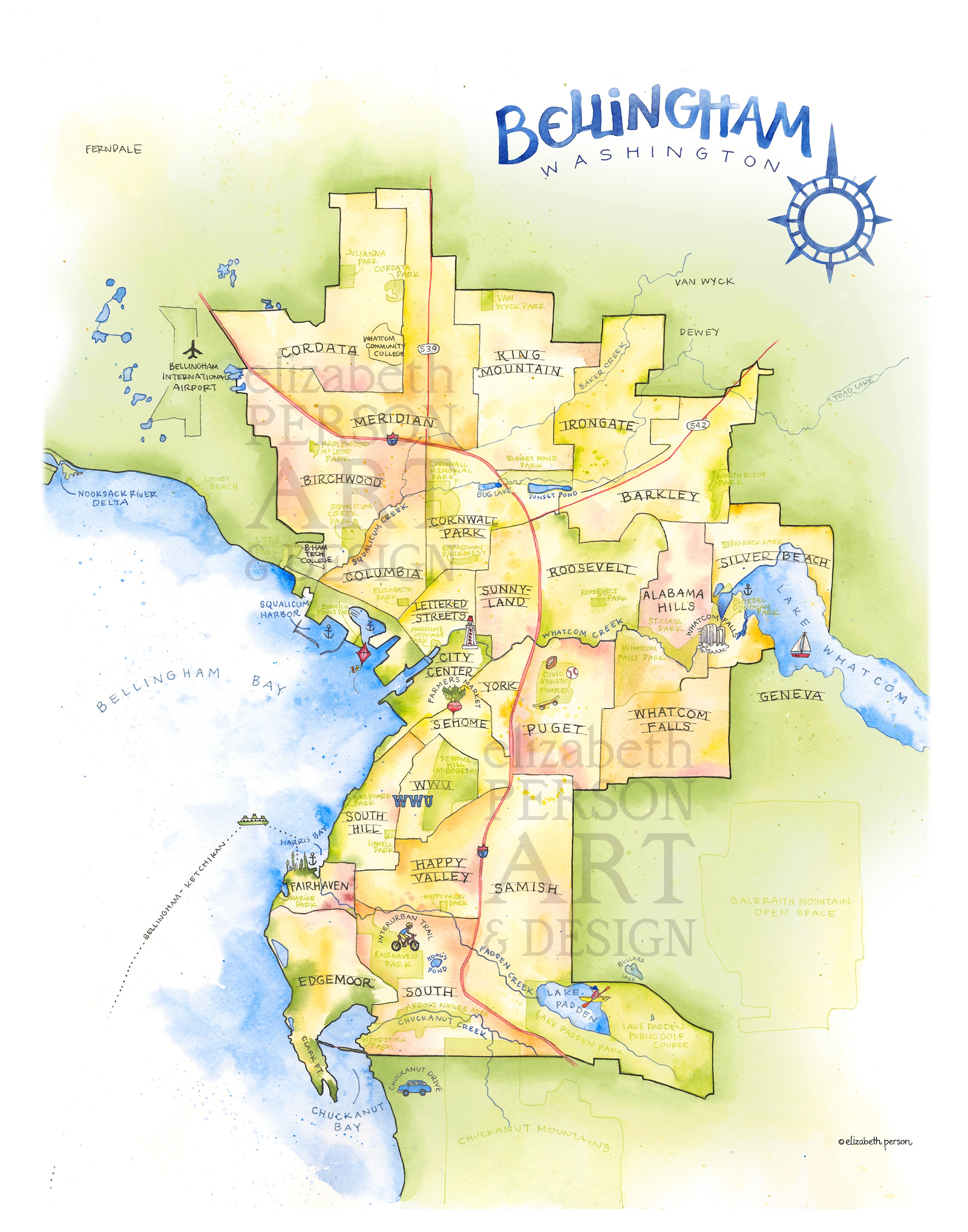

Bellingham Map 11x14" Art Print
Beautiful Bellingham, Washington, boasts distinct neighborhoods, stunning views, extensive trails and a walkable downtown. Like Seattle, it is nestled between two bodies of water: Lake Whatcom to the east and Bellingham Bay (part of Salish Sea) to the west. It's the largest city in Whatcom County, bordering Canada.
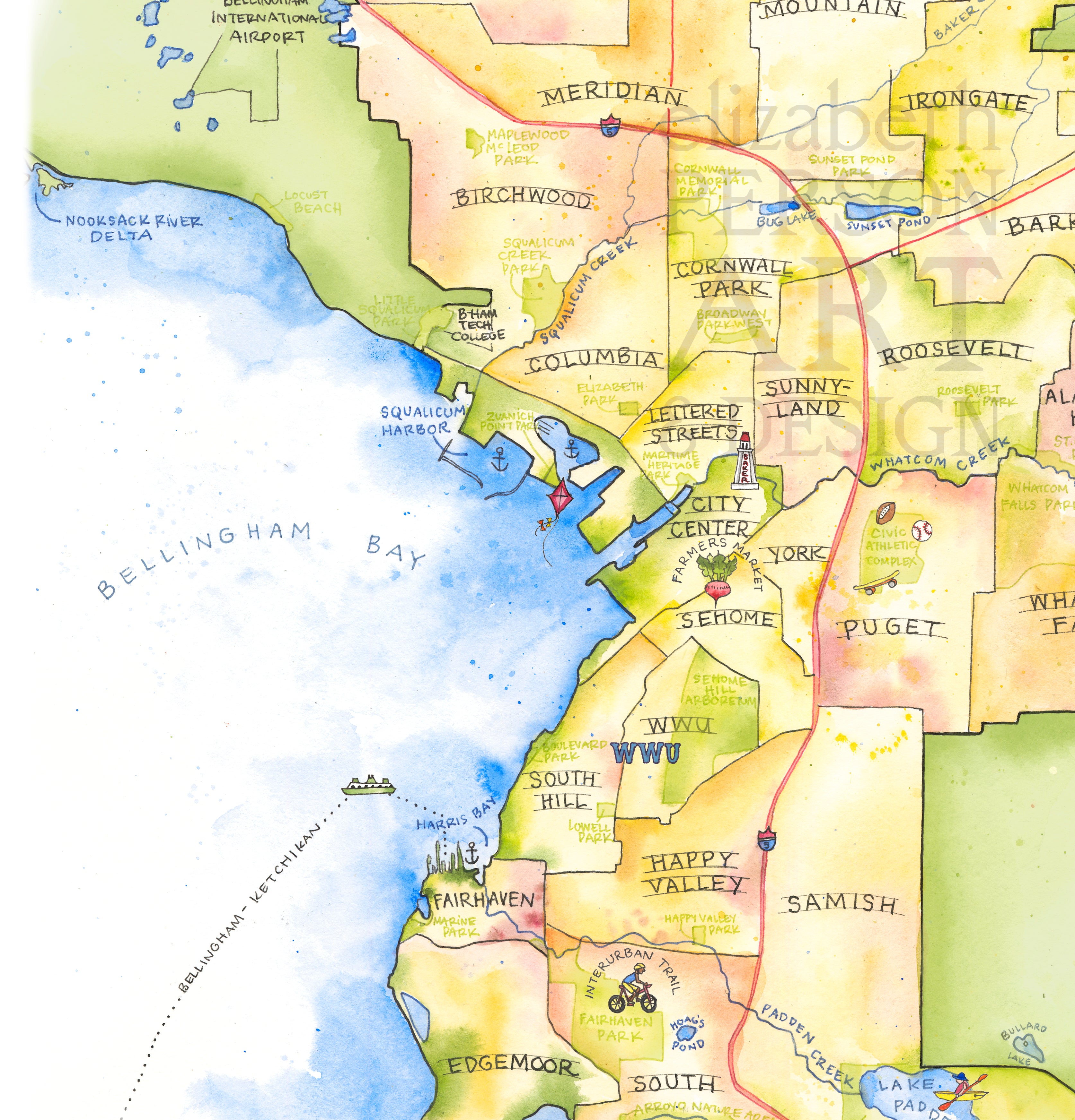
Neighborhoods (like Fairhaven and Whatcom Falls), landmarks, waterways, parks, major roads are all identified on this handcrafted map in delicate watercolor. WWU (Western Washington University), Lake Padden, Farmers Market, and Ferry service are all highlighted as well. Ideal for a student dorm, or a conversation piece in any room!
This is an unframed 11x14" archival print on high-quality matte paper. Watermark is not included on the physical print. Email me for larger print options including 16x20 and 18x24.