See more: Art Print


Lake Chelan Art Print
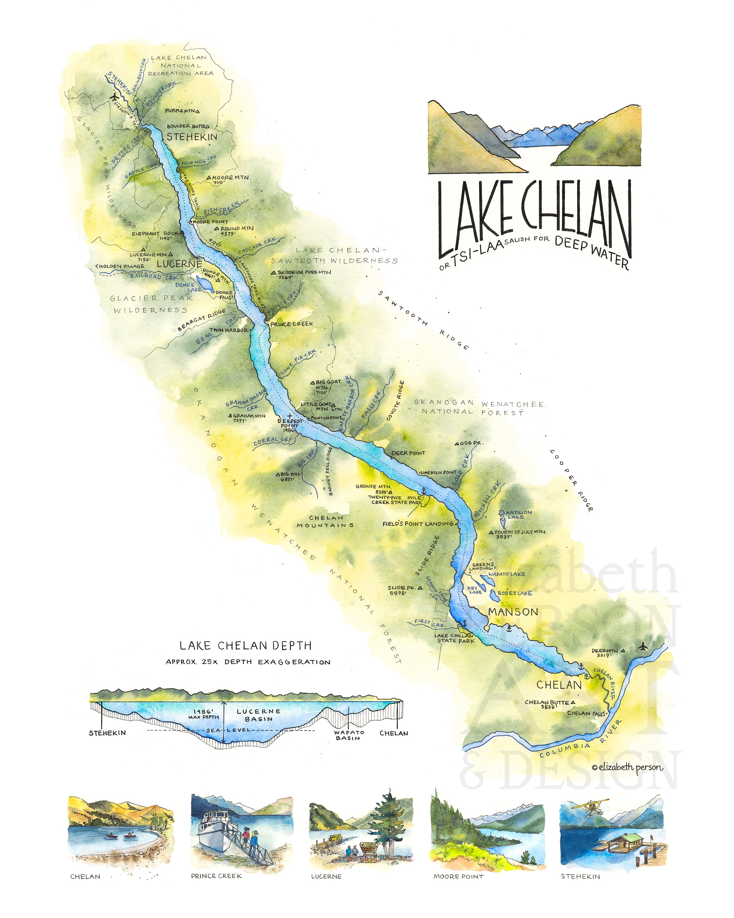
Lake Chelan is the third deepest lake in the United States! The Salish name for Lake Chelan is Tsi-Laa, meaning "deep waters." It snakes through Central Washington and nestles between North Cascades National Park, Glacier Peak Wilderness, Okanogan Wenatchee National Forest and Lake Chelan Recreational Area. At 55 miles long, this fjord-style lake is uniquely narrow! The Lady of the Lake ferry services the lake with stops at Chelan, Field's Point Landing, Prince Creek, Moore Point, Lucerne (and Holden Village) and Stehekin. The northern part of the lake is extremely remote, with no roads in. The southern part of the lake in Manson and Chelan is a summer destination for Washingtonians who flock to its beaches and water activities.
Lake Chelan is surrounded by backpacking and hiking trails, especially out of Stehekin. It's very close to the Pacific Crest Trail, so hikers use this remote town for a refuel and post office pickup point. There are numerous boat-in camp sites all around the northern portion of the lake.
This illustration features an aerial map of the lake, a diagram of its unusual depth, and five vignettes of destinations along the lake. Ideal for cabin decor, or a unique present for someone who loves to travel and vacation at the Lake!
Original was created with watercolor and ink
This is an unframed archival print on high-quality matte paper. Watermark is not included on the physical print.